 This is the Web Edition of "A Trip Into Space", a Coimbra-based electronic book on space science. Both the texts and the photos are by courtesy of National Aeronautics and Space Administration.
| This is the Web Edition of "A Trip Into Space", a Coimbra-based electronic book on space science. Both the texts and the photos are by courtesy of National Aeronautics and Space Administration.
|
A Trip Into Space  Jupiter Satellites Jupiter's Satellite Europa - Surface View Jupiter Satellites Jupiter's Satellite Europa - Surface View |
|
| See also: Jovian Satellite Fact Sheet |   |
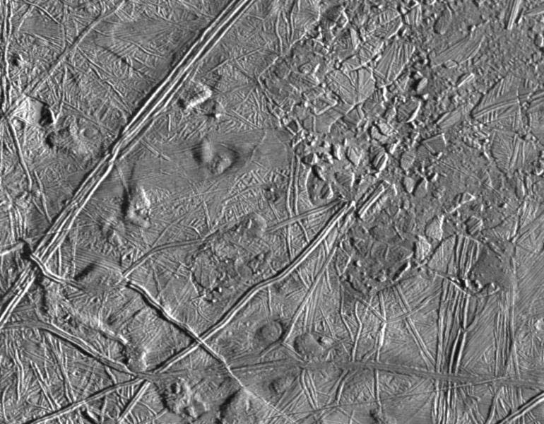
This picture of Europa was taken by Galileo's Solid State Imaging system from a distance of 17,900 kilometers (11,100 miles) on the spacecraft's sixth orbit around Jupiter, on February 20, 1997.
Launched in October 1989, Galileo entered orbit around Jupiter on December 7, 1995. The spacecraft's mission is to conduct detailed studies of the giant planet, its largest moons and the Jovian magnetic environment. The Jet Propulsion Laboratory, Pasadena, CA manages the mission for NASA's Office of Space Science, Washington, DC.
Last Update: 2005-Nov-29